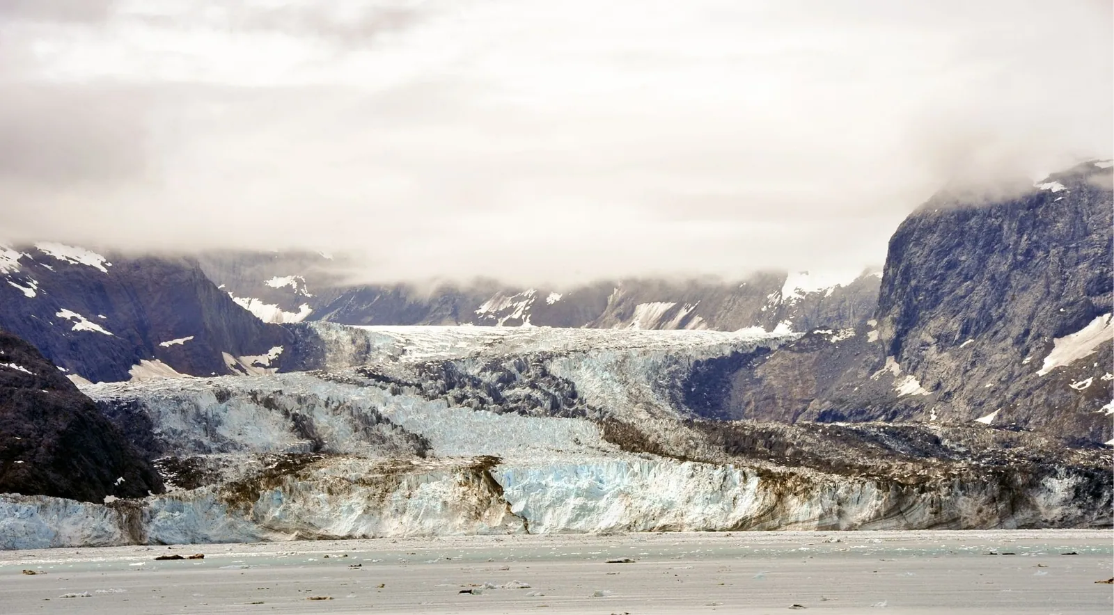
Only a handful of Kenai Fjords glaciers are realistically seeable on a normal trip: Exit Glacier, the only one reachable by road, and the tidewater glaciers Aialik and Holgate, the standard day-cruise stops from Seward. Everything else — Bear, Northwestern, McCarty, Pedersen — requires a full-day cruise, a kayak-and-water-taxi trip, or a flight, and several are effectively off-limits to casual visitors. Nearly 51% of the park is covered in ice, almost all of it flowing from the Harding Icefield, and most of it is shrinking: a 2022 Journal of Glaciology study (Black & Kurtz) found 13 of 19 studied glaciers in substantial retreat, and NPS reports the park's glaciers lost 252 km² (11.2%) of ice from 1950 to 2005.
The Harding Icefield is the engine behind almost everything a visitor comes to see. It is fed by enormous snowfall, and from its high plateau of ice, glaciers spill outward in every direction — some ending in valleys, some in lagoons, and a few still reaching all the way to the sea. Calving happens year-round — it isn't truly seasonal — but the best window to see it is mid-June through August, when weather is most reliable and the outer fjords are most accessible. Understanding the icefield first makes the coastline, the calving glaciers and the sea stacks along a cruise route fall into place.
Sources disagree on the size — here's the range
NPS cites roughly 700 square miles (1,800 km²) for the icefield proper, of which about 1,100 km² (424.8 sq mi) lies within the park; Wikipedia adds an "over 1,100 square miles" figure when counting all outflowing glaciers; and the Black & Kurtz 2022 study uses 2,080 km² (per Loso et al. 2014). Maximum depth is about 4,000 feet, the highest surface sits around 5,200 feet above sea level, and it collects roughly 60 feet of snow annually off the Gulf of Alaska. Peaks poking through the ice are called nunataks — Bear Glacier, for example, has two medial moraines originating from two nunataks.
NPS states "at least 38" glaciers flow from the icefield, of which its 2026 fact sheet lists 13 that terminate within park boundaries: Lowell, Exit, Bear, Skee, Lechner, Aialik, Addison, Pedersen, Holgate, Northwestern, McCarty, Dinglestadt and Split — a count that has grown from older fact sheets, which listed 12.
The icefield persists because of a simple equation: heavy maritime snowfall plus cool, wet summers mean much winter snow survives to compress — through névé and firn — into glacial ice over 4–10 years. But it is losing mass. Aðalgeirsdóttir, Echelmeyer & Harrison (1998, Journal of Glaciology) found the icefield lost about 34 km³ of volume between the 1950s and mid-1990s, an area-averaged elevation drop of about 21 meters (a thinning rate of −0.49 ± 0.12 m/year). VanLooy et al. (2006, Geophysical Research Letters) found thinning accelerated to −0.72 ± 0.13 m/year by the late 1990s, roughly 1.5 times the earlier rate. A peninsula-wide study (Yang et al. 2020, Journal of Glaciology) found glacier area shrank 12% (543 km²) between 1986 and 2016, with the most negative mass balance (−0.94 m w.e./year) in 2005–2014 — nearly double earlier rates.
Ice carved the valleys, then the sea flooded them
As the glaciers of the Harding Icefield flowed toward the coast, they ground out deep U-shaped valleys in the Kenai Mountains. Over time the land subsided and sea levels rose, and the ocean flooded those carved valleys. The result is the fjords: long, steep-walled arms of the sea reaching back toward the ice.
The islands and sea stacks visitors pass on a cruise are the tops of what were once mountains — former summits left standing above the flooded valley floors. The same process explains why so few glaciers still touch salt water: as the ice has pulled back, most have retreated into their valleys, and only three of the park's fjords still hold active tidewater glaciers today.
The kinds of glaciers you'll see
Glaciers here take different forms depending on where they end.
Tidewater
Aialik · Holgate · Northwestern · (historically) McCarty
- Flow directly into the sea and calve dramatically off their face
- Governed as much by fjord geometry as climate — the "tidewater glacier cycle." They sit on underwater moraine shoals that stabilize the ice; once they retreat off the shoal into deeper water, calving accelerates into a runaway retreat
- Counterintuitively, tidewater termini can be relatively stable even during warming, because the cycle is partly self-driven — in one study, tidewater glaciers had the least negative mass balance of any type (−0.45 m w.e./year)
- The reason full-day fjord cruises exist
Lake-terminating (proglacial-lake)
Pedersen · Bear (lagoon) · Yalik
- End in a lake or lagoon rather than the open sea
- Retreat fastest of any glacier type in the park — Yang et al. found lake-terminating glaciers had the most negative mass balance (−1.37 m w.e./year), because warm lake water drives high submarine melt and buoyant calving
Valley, piedmont & hanging
Exit Glacier · slopes above the fjords
- Valley/alpine glaciers are confined to mountain valleys — what Exit Glacier has become
- Piedmont glaciers spread into a lobe on lowland; Exit was historically piedmont-shaped before retreating into a valley glacier
- Hanging glaciers cling to steep slopes above the main valley, visible high on fjord walls throughout the park
Other experiences you might enjoy
Live availability for the ways to actually reach these glaciers — day cruises to Aialik Bay and Northwestern Fjord, sea kayaking at Bear Glacier Lagoon, guided hikes at Exit Glacier, and flightseeing over the Harding Icefield.
Browse all Seward & Kenai Fjords tours
Free cancellation on most tours · Secure checkout via GetYourGuide
Every named glacier, and how — or whether — you can see it
The "biggest" and "most dramatic" glaciers are the hardest to see. Marketing that implies easy access to Bear, Northwestern or McCarty overstates reality.
| Glacier | Type | What the record shows |
|---|---|---|
| Exit | Valley (formerly piedmont); road-accessible | The park's most visited and only road-accessible glacier, at the end of Herman Leirer Road (~8.4 miles off the Seward Highway). Per Kurtz & Baker (2016), it retreated 2.5 km from its 1815 Little Ice Age maximum to its September 2015 position, with the 2011–2015 average rate at 44.5 m/year. The NPS measured 187 feet of retreat in the year ending fall 2014 (about 80% of it in summer), and a record 252 feet in summer 2016 (293 feet over the full year ending October 2016). From 1815 to 1999 it averaged 43 feet/year. The Glacier View Loop (1 mile, wheelchair accessible) and Glacier Overlook Trail offer views, but the trails no longer reach the ice — retreat has left the old viewing pavilion (built 1987) staring at alders. Check the Nature Center for current conditions before you go |
| Bear | Lake-terminating (proglacial lagoon); the park's largest | The park's longest glacier at about 12 miles, ending in a lagoon full of building-size icebergs. You cannot get close on a standard cruise — it's glimpsed distantly from Resurrection Bay, weather permitting. Reaching it takes a water taxi + kayak/SUP trip into the lagoon, or a helicopter. Per the UW/NPS summary of Black & Kurtz, it retreated about 5 km (3 miles) between 1984 and 2021, losing roughly 17 km² of area. It also hosts the park's only glacier-dammed lake, producing near-annual glacial lake outburst floods |
| Aialik | Tidewater; the reliable cruise star | About a mile wide with a documented calving face around 200 feet (61 m) above water — the most dependable close-up tidewater experience from Seward. Because its accumulation zone vastly exceeds its ablation zone, it retreats slowly: Molnia's USGS repeat photography shows it retreated only ~300 m and thinned 20–50 m from 1909 to 2005, staying near its 1909 position. Boats stay ~¼ mile back and typically spend 20–30 minutes; calving is frequent. Some operators advertise a "500-foot" ice wall — that appears to be marketing exaggeration; the ~200 ft/61 m figure is the documented value |
| Holgate | Tidewater; the surprise advancer | In Holgate Arm off Aialik Bay, narrower but tall, and a popular cruise and kayak stop. The Black & Kurtz 2022 study found Holgate advanced in recent years (roughly a third of a mile, ~2010–2021), one of only two advancing glaciers studied — a product of the tidewater cycle building a protective sediment shoal, not climate. Per NPS's Deb Kurtz, this advancing stage builds a shoal that reduces calving and buffers warm marine water. Holgate began a small retreat 2021–2023, ending just behind its 1986 position. Holgate Arm is often ice-choked |
| Northwestern | Tidewater; remote, dramatic recession | At the head of Northwestern Fjord off Harris Bay, reached only on the longest Seward cruises or by kayak/water-taxi expedition. It retreated about 5,200 m (1950–1986) and another ~1,600 m since, splitting into arms; its 1909 terminus has retreated more than 6 miles out of the old photo frame. Kayak outfitters note the crossing of its submerged terminal moraine some 8.75 miles from the current face |
| Pedersen | Lake-terminating; Aialik Bay | Ends in a lagoon; Molnia documented ~1.5 km retreat 1909–2004, and per the UW/NPS summary of Black & Kurtz it retreated about 3.2 km (two miles) between 1984 and 2021, now roughly six miles long. Seen on some kayak/overnight trips into Pedersen Lagoon; not a standard cruise stop |
| McCarty | Formerly tidewater; extreme retreat | In remote McCarty Fjord (~50 miles from Seward). USGS Molnia repeat photography shows a retreat of more than 15 km (9.8 miles) between 1909 and 2004 — it retreated out of the photo frame entirely, one of Alaska's most extreme documented recessions, reaching shallow water at its head around 1960. Effectively unseeable except by private boat or flightseeing |
The lesser-known glaciers — Lowell (feeds Resurrection River near the Exit road), Skee, Lechner, Addison, Split, Anchor, Ogive, Chernof, Dinglestadt, Yalik and Petrof — are largely inaccessible to ordinary visitors; several are land-terminating and out of sight, or sit in remote fjords like Nuka Bay and McCarty Fjord. Dinglestadt and Split are among the park-terminating glaciers that see essentially no tourism. Yalik lost 2.27 km of length and 6.92 km² of area between 1984 and 2021.
Glaciers people confuse with Kenai Fjords — these are NOT in the park: Portage & Byron Glaciers (Chugach National Forest, near Girdwood/Turnagain Arm, ~1 hour from Anchorage — Portage ends in a lake, has receded out of sight from its visitor center, and is seen by boat tour; Byron by an easy ~1-mile walk); Spencer Glacier (Chugach National Forest, uniquely train-accessible via the Alaska Railroad whistle stop); Matanuska Glacier (Glenn Highway northeast of Anchorage, road/guided-walk accessible, land-terminating; the walk-on point is privately owned, guided tours only); Knik & Colony Glaciers (Chugach Mountains near Palmer, best by helicopter); Godwin Glacier (near Seward but outside the park — the helicopter dog-sledding glacier); and Harvard & Yale Glaciers (College Fjord, Prince William Sound, not Kenai Fjords).
Seven access methods, compared
| Method | Cost tier | What you get |
|---|---|---|
| By road (Exit Glacier) | Free/low-cost | Easy, family-friendly; short walks with icefield views but no ice contact. Road open roughly mid-May to late October, closed to cars in winter (open to skiing, dogsledding, fat bikes). Best for time-constrained travelers |
| By day cruise from Seward | Moderate–higher | The mainstream option. A 6-hour cruise reaches one tidewater glacier in Aialik Bay; a 7.5-hour cruise typically reaches both Holgate and Aialik; the Northwestern Fjord full-day cruise (roughly 8.5–9 hours) reaches the remote fjord's tidewater glaciers and crosses open Gulf water. Low physical demand, weather-dependent. Best all-around choice for most visitors |
| By kayak + water taxi | Higher | Guided day trips to Aialik Bay or Northwestern Fjord (captain's choice by conditions), plus Bear Glacier Lagoon kayaking and overnight expeditions to Pedersen Lagoon/Holgate. Intimate, quiet, close to ice; water-taxi transport can be well over half the price; requires fitness and cold/wind tolerance, very weather-dependent. Best for active travelers seeking immersion |
| By helicopter/flightseeing | Highest | Flights over the Harding Icefield and to Bear or Godwin Glacier, some with glacier landings. Minimal physical demand; the only way to grasp the icefield's scale; entirely visibility-dependent. Best for splurgers and those short on time |
| By glacier dog-sledding | High | Helicopter to a summer dog camp on Godwin Glacier (outside the park) near Seward — a "winter in summer" novelty combining flightseeing, a glacier landing and mushing. Low physical demand, weather-dependent (operators refund if they can't fly) |
| By hiking (Harding Icefield Trail) | Free | The park's marquee hike, about 8.2 miles round trip with roughly 3,500 feet of gain, delivers the icefield panorama. Strenuous; roughly June to early October; no special gear needed in summer but bring layers |
| Ice climbing / guided trekking | Moderate–higher | Guided trips, for example on Exit Glacier, for hands-on ice time with crampons and instruction. Demanding; a guide is required for safety |
Enormous snowfall, ice in a few years
The Harding Icefield exists because far more snow falls each winter than melts each summer. The icefield receives very heavy snowfall off the Gulf of Alaska — roughly 60 feet (about 720 inches) per year. That surplus feeds the ice that flows outward as glaciers.
With snowfall that heavy, glacial ice can form remarkably fast. Fresh snow compacts, recrystallizes and eventually turns to solid glacier ice under the weight of the snow above it — a process called firnification, passing through névé and firn — and in Alaska's maritime climate it can complete in as little as 4 to 10 years.
In one line: the icefield is about 700 square miles of ice, feeds at least 38 glaciers, and covers roughly 51% of a park of about 669,984 acres. Figures vary by source — treat them as approximate.
Glacier retreat and climate data, source by source
Most of the park's glaciers are retreating, and Exit Glacier's retreat is marked year by year along its trail. For a fuller narrative treatment, see Glacier Retreat; the primary sources are below.
- Kurtz & Baker 2016, Two Hundred Years of Terminus Retreat at Exit Glacier: 1815 to 2015 (NPS NRR—2016/1341): 2.5 km centerline retreat over 200 years, accelerating to 44.5 m/year in 2011–2015.
- Black & Kurtz 2022, Journal of Glaciology (DOI 10.1017/jog.2022.55): mapped 19 maritime glaciers 1984–2021; 13 substantially retreated, 4 relatively stable, 2 advanced (Holgate and debris-covered Paguna). Cumulatively the lower reaches lost 42 km². Land-terminating glaciers showed an intermediate response; lake-terminating retreated fastest; tidewater were most variable.
- USGS Molnia repeat photography (Glacier Photograph Collection / NSIDC): the McCarty (>15 km), Northwestern (>6 miles), Pedersen (~1.5 km) and Aialik (~300 m) century-scale pairs.
- NPS: 252 km² / 11.2% ice loss 1950–2005.
- USGS Benchmark Glaciers (2025 results, released December 2024/2025): nearby Wolverine Glacier (Kenai Mountains) gained mass in 2025 — its first positive annual balance since 2012, ending a 12-year negative streak — after a strong snow winter, while Gulkana and Lemon Creek lost mass for the 17th and 13th consecutive years respectively. A reminder that single good years occur against a long-term losing trend, and that this data applies to benchmark glaciers, not the Harding Icefield directly.
Exit Glacier's retreat markers along the road and trail are dated from 1815 (Little Ice Age maximum) forward, including 1917 (now about a mile from the terminus) and various 20th- and 21st-century positions; more than 11 recessional moraines are marked.
Best time to see the glaciers
Peak season is mid-June through August for reliable weather, warmest temperatures and full tour operations.
May / early June
Bluer ice, fewer crowds
- Snow lower on peaks, pristine bluer exposed ice, fewer crowds
- But the Exit Glacier road may still be closed (often through mid-May)
- Outer fjords can be less reliably reached, and lagoons like Bear can be so ice-choked that kayaking is difficult
July / August
Most reliable access
- Warmest, greenest, most reliable outer-fjord and lagoon access
- Peak wildlife — whales, puffins
- Trade-off: busiest and rainier
September
Fall color, fewer ships
- Fall color, dramatic light, fewer ships
- Still-strong glacier viewing
- But cooler, shorter days, and services winding down
Calving is largely year-round, not strictly seasonal — it's driven by ice dynamics, not just temperature. But summer's meltwater lubrication and warmer conditions do make activity more frequent and reliable.
Why glacier ice is blue, and how to shoot it
Why glacier ice is blue: dense, bubble-free glacial ice absorbs long-wavelength (red/orange) light and transmits or scatters short-wavelength blue, so the thicker and more compressed the ice, the bluer it looks (NASA, WHOI, American Chemical Society). Freshly calved or crevasse-exposed ice is bluest; surface ice weathers white within hours as air-filled cracks form.
Practical tips: low, angled light makes blue ice glow more than flat midday sun; photographers often underexpose to keep blue from blowing out; a polarizer cuts water glare; bring a fast lens for low light and a telephoto for calving faces, since boats stay back. Boats stay about ¼ mile (occasionally as close as ~1,000 feet) from tidewater faces and typically spend 20–30 minutes at a glacier. Keep waterproof gear ready.
What can go wrong near ice, and how to avoid it
Calving hazards
- Never approach a calving face on foot or touch the ice — the NPS closed Exit Glacier's ice-contact access as the toe retreated and because of ice-fall and rockfall hazard
- Calving waves: sudden waves from calving can hit shorelines with surprising power and sweep away kayaks and gear stored above the tide line, even overnight
- Kayaking near calving faces should keep well back; guides enforce standoff distances
Bear Glacier GLOFs
- The ice-dammed lake ~12 km above Bear's terminus drains every 1–2 years, raising lagoon levels by up to ~2 meters
- A 2010 GLOF raised the lagoon 5.9 feet; the August 2014 event breached the moraine into Resurrection Bay, sending standing waves ~2 miles out and washing kayaks and canoes into the bay
- GLOFs cluster August–October. Floating ice may persist at the mouth of Resurrection Bay; boaters should watch for ice
- Rapid glacier retreat also debuttresses slopes, raising landslide risk in the fjords — a documented emerging geohazard flagged by NPS
How it compares with other Alaska glacier destinations
| Destination | What it's known for |
|---|---|
| Kenai Fjords (Seward, ~2.5 hrs from Anchorage) | Easiest from Anchorage and the best wildlife-plus-glacier combo — a marine wildlife cruise capped by a tidewater glacier. Best if you want otters, sea lions, puffins and whales with your ice |
| Prince William Sound (Whittier, ~1 hr; also Valdez) | The densest concentration of tidewater glaciers — cruises like the 26-glacier tour pass 20+ glaciers in calmer, sheltered water. The pick for glacier density and seasickness-prone travelers, though with less wildlife than Kenai Fjords |
| Hubbard Glacier | The biggest single glacier — a roughly 6-mile-wide, 400-foot face — but seen mostly from large cruise ships (kept ¼–1 mile back), in an open bay rather than an intimate fjord, and not a Seward day trip |
| Glacier Bay | The classic national-park boat experience — cruise-ship and day-boat access only, no road; boats required to stay ¼ mile from glaciers |
| Tracy Arm / Endicott Arm (near Juneau) | Narrow-fjord drama — tight, waterfall-lined fjords with the Sawyer and Dawes glaciers, reached from Southeast Alaska, not the road system |
For a road-trip traveler based in Anchorage or Seward who wants tidewater glaciers and abundant wildlife in one accessible day, Kenai Fjords is the best pick; choose Prince William Sound if you prioritize glacier quantity and calm water, and the big-ship destinations only if you're already on a cruise itinerary.
Match the glacier to the access method
One day, glacier guaranteed
Take a 6-hour Seward day cruise to Aialik Bay. Aialik is the most reliable close-up tidewater glacier, and you'll also get wildlife. Book the departure that aligns with the Alaska Railroad if coming from Anchorage.
Want more, and can spare the time
The 7.5-hour cruise (two glaciers, more wildlife) or the Northwestern Fjord full-day cruise (most dramatic recession, remote fjords) — but only if you tolerate open-water swells; take seasickness precautions.
Active and want immersion
A guided kayak + water-taxi day trip to Aialik Bay, or Bear Glacier Lagoon for the iceberg experience. Go July–August so lagoons aren't ice-locked.
Only a few hours, or just a car
Drive to Exit Glacier, walk the Glacier View/Overlook trails (accepting you won't touch ice), or attempt the Harding Icefield Trail if fit.
A bucket-list splurge
A helicopter flightseeing trip over the Harding Icefield, ideally with a glacier landing, or Godwin Glacier dog-sledding.
Timing & expectations
Target mid-June to late August; shift earlier only if you prize solitude and bluer ice (and can accept access limits), or to September for fall color and fewer crowds. Don't book a standard cruise expecting a close Bear, Northwestern or McCarty experience — match the glacier to the access method. If the Exit Glacier road is still gated (check NPS alerts before mid-May), substitute a cruise; if a Bear Lagoon GLOF advisory is active or the lagoon is ice-choked, switch to Aialik kayaking; if marine forecasts show high seas or wind, pick a sheltered Aialik Bay itinerary over Northwestern Fjord.
Glacier & geology questions
The Harding Icefield covers about 700 square miles of ice atop the Kenai Mountains, making it the largest icefield entirely within the United States. It is fed by enormous snowfall, roughly 60 feet (about 720 inches) per year off the Gulf of Alaska. Overall icefield size figures vary by source.
At least 38 glaciers flow outward from the Harding Icefield. Roughly 51% of the park is covered by ice, and the park itself is about 669,984 acres. Only three of the park's fjords still hold active tidewater glaciers today.
A tidewater glacier flows all the way down to the sea and terminates in salt water, where it calves icebergs off its face. Aialik, Holgate and the Northwestern Fjord glaciers are the active tidewater glaciers visitors reach on cruises.
Bear Glacier is the park's largest. It is a valley and piedmont glacier that now ends in a growing, iceberg-filled proglacial lagoon holding building-size icebergs, and it is typically reached by kayak or helicopter rather than on standard boat cruises.
Exit Glacier is the only road-accessible glacier and can be walked to. Aialik and Holgate are active tidewater glaciers in Aialik Bay reached on full-day cruises, and Northwestern Fjord, the deepest cruise destination, holds three tidewater glaciers. Bear Glacier's lagoon is reached by kayak or helicopter.
Dense, bubble-free glacial ice absorbs long-wavelength red and orange light and transmits or scatters short-wavelength blue, so the thicker and more compressed the ice, the bluer it looks. Freshly calved or crevasse-exposed ice is bluest; surface ice weathers white within hours as air-filled cracks form.
Mid-June through August is the peak window for reliable weather and outer-fjord access. Calving happens year-round, not just in summer, but May and early June bring bluer exposed ice and fewer crowds at the cost of a possibly still-closed Exit Glacier road, and September brings fall color and fewer boats but cooler, shorter days.
Guided trips are the standard approach, and guides enforce standoff distances from calving faces. Bear Glacier's ice-dammed lake drains every 1 to 2 years in a glacial lake outburst flood that can raise lagoon levels several feet, and these events cluster August through October. Never approach a calving face on foot, and check current conditions with outfitters before a trip.
Related guides
See the ice for yourself
The tidewater glaciers are reached only by water. Compare cruises from Seward and pick the run that reaches the glaciers you want to see.